Last updated on April 11th, 2023
10 Facts about Niger’s economy and people
21. Niger is a landlocked country with over 80% of land being arid.
22. A mere 2.8% of the total land area in Niger is cultivated.
23. The country’s last census report (2002) indicated that 90% of the country’s workforce is engaged in Agriculture whilst industry and commerce employ 6% of the workforce, and the government employs the remaining 4% of the citizens.
24. The nation has a single trade union federation, The Union of Worker’s Syndicate of Niger. The head of the Union is appointed by the Government and most members are state employees.

25. The mains agricultural export from Niger is peanuts; the second largest agricultural export is cotton.
26. A mere one percent of Niger’s total surface area is under forest cover.
27. Uranium is Niger’s largest mineral export. The country is ranked fifth in Uranium production globally.
28. Minerals that Niger has in abundance include gold, iron ore, sulfates and a raft of other minerals that are untapped.
29. As of the year 2003, the country had crude oil reserves of close to 300 million barrels of fuel. Because of lack of refining capacity, however, the country has to rely on imports for refined petroleum.
30. Commercial fishing is nonexistent as an industry and most of the catch is consumed domestically.
10 Niger facts for Kids

31. Niger is on the border between Sahara and Sub-Sahara region.
32. The capital of Niger is Niamey.
33. Niger borders seven countries.
34. The countries bordered are Libya to the North East, Chad to the East, Nigeria and Benin to the South and South West, Senegal and Mali to the West and Algeria to the North West.
35. The longest border is with Nigeria that lies in the South.
36. The lowest point in the country is in River Niger.
37. The highest point in the country is in Mount Idoukalan – Taghes in the Air Mountains.
38. The climate of Niger is subtropical climate which means it’s hot and dry.
39. Niger has a population of 18,638,600 (July 2016 est.)
40. Present day Niger stands on what was previously the empires of Mali and Songhai.
More facts about Niger’s economy, culture, military, wildlife etc
41. With a land area of 1,267,000 km square km, Niger is the largest country in West Africa.
42. Niger is one of the poorest nations on the earth with a UN Human Development Index of 2022 ranking it as 189th in the world.
43. Niger has a rich cultural history having been the stomping ground of some of Africa’s most notably empires and kingdoms. The Songhai Empire and the Mali Kingdom were domiciled in this territory.
44. Niger has had seven republics and four military regimes since its inception as a state in 1958.
45. Niger teems with wildlife with the two most prominent Parks being the W National Park and Abaaba National Park.

46. The country has one of the world’s largest protected reserves covering 7.7m Ha land. Cheetah, Oryx, and different gazelle are to be found on this territory.
47. Dinosaur remains are also to be found in an area within the Sahara desert.
48. Tuareg men wear blue dyed veils across their eyes and were referred to as the “Blue Men” of the Sahara Desert in bygone times.
49. Niger is considered one of the hottest nations in the world and is aptly nicknamed the “Frying Pan of the World.”
50. The country is divided into seven regions with a single Principal District, the capital, Niamey.
Niger – country at a glance
| Independence | 3 August 1960 (from France) |
|---|---|
| Capital City | Niamey (13°32′N 2°05′E) |
| Largest City | Niamey (13°32′N 2°05′E) |
| Area | total: 1.267 million sq km land: 1,266,700 sq km water: 300 sq km |
| Population | 26,342,784 (2024 est.) |
| Literacy | 35.1% |
| Demonym | Nigerien |
| Official Language | French |
| National anthem | "La Nigerienne" (The Nigerien) |
| National symbol | Zebu |
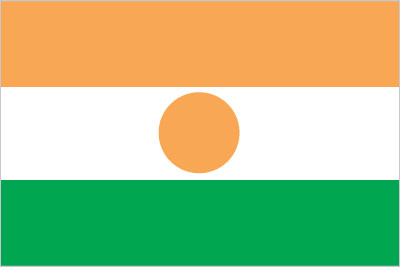
| National colors | orange, white, green |
| Government type | semi-presidential republic |
| CNSP President | Abdourahamane Tchiani |
| Prime Minister | Ali Lamine Zeine |
| Borders | Libya, Algeria, Benin, Burkina Faso, Mali and Chad |
| Currency | West African CFA franc (XOF) |
| Religion | Islam, Animism and Christianity |
| Life expectancy at birth | 60.9 Years (2024) Life expectancy at birth indicates the number of years a newborn infant would live if prevailing patterns of mortality at the time of its birth were to stay the same throughout its life. |
| Climate | desert; mostly hot, dry, dusty; tropical in extreme south |
| Terrain | predominately desert plains and sand dunes; flat to rolling plains in south; hills in north |
| Mean elevation | 474 m |
| Lowest point | Niger River 200 m |
| Highest point | Idoukal-n-Taghes 2,022 m |
| Natural resources | uranium, coal, iron ore, tin, phosphates, gold, molybdenum, gypsum, salt, petroleum |
| Agricultural land | 35.1% |
| Birth rate | 46.6 births/1,000 population (2024 est.) |
| Death rate | 9.5 deaths/1,000 population (2024 est.) |
| Sex ratio | 0.98 male(s)/female (2024 est.) |
| Industries | uranium mining, petroleum, cement, brick, soap, textiles, food processing, chemicals, slaughterhouses |
| Exports | $1.376 billion (2022 est.) gold, sesame seeds, uranium, natural gas, refined petroleum (2019) |
| Imports | $4.194 billion (2022 est.) rice, packaged medicines, palm oil, cars, cement (2019) |
| GDP - per capita (PPP) | $1,700 (2023 est.) |
| Time Zone | WAT (UTC+1) |
| Internet country code | .ne |
| Calling Code | +227 |
| Drives on the | Right |
| Table last updated | February 21, 2025 |
