Last updated on April 12th, 2022
A river is a natural water body that flows downhill driven by the force of gravity. This flow, usually comprised of fresh water, eventually drains into another water body such as a lake, ocean, or lager river downstream. There are, however, some rivers that drain into dry ground without reaching any other water body.
What is a River Basin?
This is an area of land whose streams, groundwater, and surface runoff from precipitation contribute to a river’s flow. In essence, a river’s drainage basin serves as a funnel that collects water and feeds it into a common outlet, making the river larger as it flows downstream. This area could span anywhere from a few acres to several thousand square miles, depending on how long the river is.
Tributaries and Distributaries
We’ve just highlighted that there are rivers whose flow drains into larger rivers; these are known as tributaries. A tributary could itself be fed by smaller rivulets, but the distinguishing factor is that it doesn’t flow directly into a lake/ocean.
Speaking of which, there also are rivers that branch off into smaller streams as they flow downstream. These branches, a common feature of river deltas, are known as distributaries. A distributary’s distinguishing feature is that it doesn’t revert to its parent river once it branches out.
World’s 10 longest rivers
| Rank | River | Length (km/miles) | Source | Mouth | Direction of flow | Countries in the drainage basin |
|---|---|---|---|---|---|---|
| 1. | Nile | White Nile | Mediterranean Sea (Nile Delta, Egypt) | south to north | Egypt, Sudan, South Sudan, Ethiopia, Uganda, Congo, Kenya, Tanzania, Rwanda, Burundi | |
| 2. | Amazon | 6,400 km (3,976 miles) | Río Apurimac, Mismi Peak (Arequipa Region, Peru) | Atlantic Ocean (Brazil) | west to east | Brazil, Peru and Colombia |
| 3. | Yangtze | 6,300 km (3,917 miles) | Dam Qu (Jari Hill) (Tanggula Mountains, Qinghai) | East China Sea (Shanghai and Jiangsu) | west to east | China |
| 4. | Mississippi-Missouri | 6275 km (3,902 miles) | Lake Itasca (Itasca State Park, Clearwater County, MN) | Gulf of Mexico (Pilottown, Plaquemines Parish, LA) | north to south | United States |
| 5. | Yenisey | 5,539 km (3,445 miles) | Mungaragiyn-Gol (ridge Dod-Taygasyn-Noroo, Mongolia) | Yenisey Gulf (Arctic Ocean, Russia) | south to north | Russia |
| 6. | Yellow | 5,464 km (3,395 mi) | Bayan Har Mountains (Yushu Prefecture, Qinghai) | Bohai Sea (Kenli District, Dongying, Shandong) | west to east | China |
| 7. | Ob' - Irtysh* | 5,410 km (3,362 miles) | Altai Mountains | Gulf of Ob, Kara Sea | south to north | Mongolia and China |
| 8. | Parana | 4,880 km (3,030 mi) | Paranaíba River (Rio Paranaíba, Minas Gerais, Brazil) | Rio de la Plata (Atlantic Ocean, Argentina, Uruguay) | north to south | Argentina Brazil |
| 9. | Congo | 4,700 km (2,922mi) | Lualaba River (Boyoma Falls) | Atlantic Ocean | Initially east to west and then north to south | Democratic Republic of the Congo, Republic of the Congo, Angola |
| 10. | Amur | 4,444 km (2,763 mi) - including its source river Argun. | Onon-Shilka (Khan Khentii Strictly Protected Area, Khentii Province, Mongolia) | Strait of Tartary (Near Nikolayevsk-on-Amur, Khabarovsk Krai, Russia) | west to east | Russia and China |
| Note | The Irtysh and the Ob River, of which the Irtysh is the principal tributary, together constitute the world’s seventh longest river system.* Rivers are considered large on the basis of one or more of three characteristics: total length from source to mouth, area of basin (watershed) drained by the stream, and average rate of flow (discharge) at the mouth. River lengths or river-length data are affected not only by some of the natural and artificial causes noted in the preceding paragraph, but also by the precision of various techniques of measurement, by the scale of available maps or aerial photographs, and by somewhat arbitrary decisions. |
|||||
| Table last updated | December 12, 2021 | |||||
1. The Nile – the world’s longest river
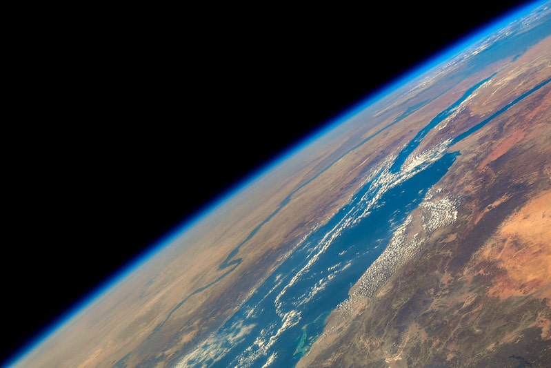
The Nile River in Northeastern Africa is the longest in the world. It flows from south to north, starting from the highlands and ending in the Mediterranean Sea just off the coast of Egypt. This body of water has played a big part in the history, culture, and economy of the region since the rise of early civilizations. Let’s take a look at some of the most interesting facts about the Nile River.

1. Etymology
The name “Nile” is thought to originate from the Greek word “neilos” or the Latin “Nilus” that translates into valley. In his work, the ancient Greek poet Hesiod called Nilus one of the river gods.
2. The Black River
Egyptians also refer to it as “Ar” which means “Black River”. That’s because the water turns dark during its annual flooding due to the presence of sediments.
The Nile on map
3. Regional Names
Each country along the river calls it by a different name. In Ethiopia, they call it Bahr el Jabal. In Sudan, it is referred to as Bahr al Ghazal. They also have local names for its tributaries.
4. White, Red, Blue, and Yellow
The major tributaries of the Nile are labeled with different colors. The White Nile begins at Uganda’s Lake Victoria. The Blue Nile springs from Ethiopia’s Lake Tana. The Red Nile originates further north. Lastly, the Yellow Nile is a former tributary that started in Chad. The Blue Nile and White Nile are two tributaries of the Nile that flow from the South into what is referred to as the Nile proper.
5. Annual Floods
The Nile River is known to swell up in the summer because of heavy rains in Ethiopia. The flooding in Egypt begins in July and lasts until September. Low flood volumes would sometimes lead to famine or crop failure.
6. The Rise of the Egyptian Civilization
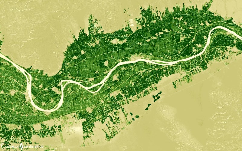
The river made the banks of the Nile fertile enough to sustain crops. Ancient Egyptians were able to trade wheat with its neighbors, ensuring their economic stability in a region plagued by famine.

7. Hapi, the God of Floods
According to Egyptian tradition, Hapi is a god who controls the flooding of the Nile. The depictions show an androgynous figure often bearing offerings. Priests conducted rituals to ensure the river’s steady flow.
8. Guardians of the Source
Other gods associated with the Nile include Khnum, Anuket, and Satet. They were thought to guard the source of the Nile. They also made sure that the water contained ample silt to promote soil fertility.
9. First Successful Irrigation
Large-scale farming would not be possible without irrigation. Ancient Mesopotamians and Egyptians were the first to successfully control the flow of water for agriculture with the latter leaning heavily on the Nile River.
10. Ancient Egyptian Calendar
Ancient Egyptians developed a calendar that revolves around the waters of the Nile. They had 12 lunar months divided into three seasons. Akhet was flooding season, Peret was growing season, and Shemu was the dry season.
11. Timing the New Year
The annual Nile flood used to mark the New Year. However, the water didn’t always start to rise on the same date. They replaced it with a more reliable astronomical marker: the appearance of the bright star Sirius.

12. The Nile Crocodile
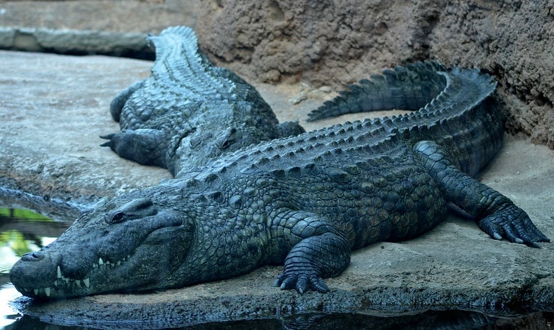
The Nile crocodile can grow as long as 20 feet and weigh as much as 1,650 pounds. Although they usually eat fish, they are known to attack anything in their path including humans. Some estimate an average of 200 fatalities every year.
13. The Origin of the Nile
Many ancients wondered how the Nile could flow continuously through a desert region and cause annual floods. Some wrongly blamed the sun, the wind, and the heat underground.
14. Reasonable Assumption
Eratosthenes (276-194 BCE) is the first person to accurately compute the Earth’s circumference. He also mapped the Nile valley and correctly observed that heavy rains at higher elevations were sufficient to cause the floods.

15. The Aswan High Dam
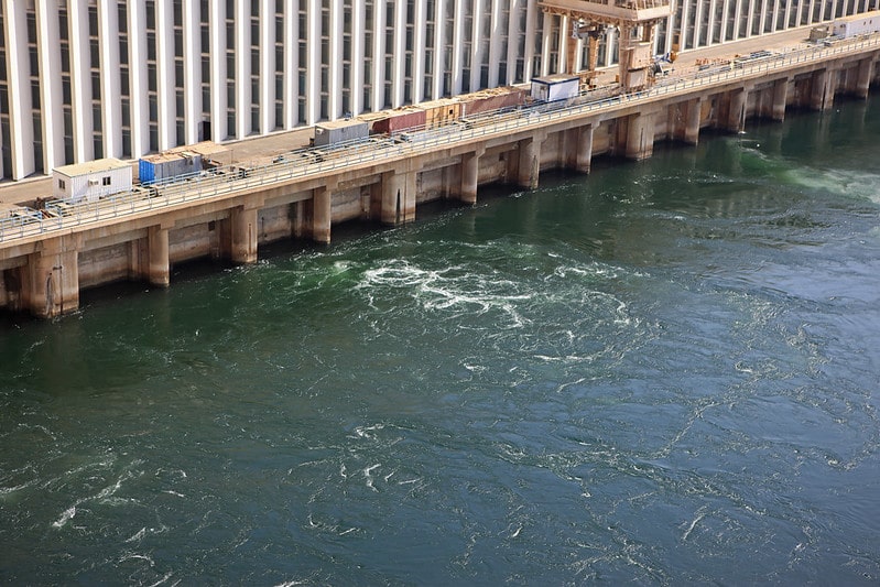
In 1970, the Aswan High Dam was completed to support Egypt’s industrialization by generating hydroelectricity, increasing water storage for irrigation, and improving flood control. It ended the natural summer floods.
16. Archaeological Site Reconstruction
The dam made relocation necessary for over 100,000 residents. Four archaeological sites also had to be reconstructed at higher elevation including the rock temple of Abu Simbel that was built by Pharaoh Ramses II.
17. Nile Explorations
In 1951, John Goddard and his two French companions became the first people to navigate the entire river from Burundi to the Mediterranean Sea. The 6,800-kilometer journey took nine months to complete.
18. Blue Nile on Kayaks
In 2005, the team of Les Jickling and Mark Tanner finished the first human-powered journey of the dangerous Blue Nile using kayaks.
19. Water Sharing Issues
Water is scarce in East Africa and countries have locked horns over this precious resource. For example, the construction of the Grand Ethiopian Renaissance Dam got strong reactions in Egypt. The Nile Basin Initiative aims to find peaceful solutions to these conflicts.
20. Nile River Transportation
The Nile served as the main highway in Ancient Egypt. Boats transported people and goods across towns at a time when land travel was slow and dangerous. They even moved massive stone blocks for the pyramids by water.
The Nile – quick facts and statistics
| Name | The Nile |
|---|---|
| Source | White Nile and Blue Nile |
| Mouth | Mediterranean Sea |
| Length | 6650 km |
| Width | maximum 2.8 km (1.7 mi) |
| Depth | average 8–11 m (26–36 ft) |
| Basin size | 3,400,000 km2 (1,300,000 sq mi) |
| Direction of flow | south to north |
| Major cities | Jinja, Juba, Khartoum, Cairo |
| Countries | Egypt, Sudan, South Sudan, Ethiopia, Uganda, Congo, Kenya, Tanzania, Rwanda, Burundi |
| Table last updated | December 5, 2021 |
continue reading on the next page . . .
